In Britain, we take particular interest in the weather which can seem to come at us all at once. A persistent consideration in the British infrastructure sector is not only the volume of rainfall but also where it settles. Location and frequency are often catalysts for planning reviews: how we can better mitigate flood risk and maintain clean water. As was seen with notable storms ‘Eva’ and ‘Desmond’, flooding can devastate local communities, farmland and the economy with the closure of roads and businesses.
The sustainable infrastructure spectrum from blue-green to grey
In my previous blog, I touched on the vast topic of green infrastructure; how it balances and uses some elements of grey or traditional infrastructure to achieve its end goal of delivering sustainable living via an eco-system. The green approach is logically paired with blue.
Grey fits somewhere on the side as ‘the devil we know’. In general terms, planning and building blue-green by default is the goal. It has challenges largely due to the need to retrofit elements. This is most common in the context of urban development in already built-up areas. Planners are obliged to work with existing grey infrastructure.
Blue-green infrastructure requirements
Traditionally, clean water for drinking, hygiene and sustaining the natural environment have been facilitated via grey infrastructure: filtration and purification systems to treat wastewater which then goes back into the cycle of domestic or commercial use. However, not all clean water is drinking water. Trace pollutants need to be considered by suppliers due to potential public health risk.
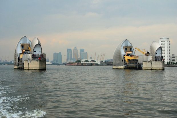
Industrial purification methods have been implemented in locations such as the Thames region where rainfall is sub-optimal and concerns over drought have been expressed. The immediate solution has been to source and purify water from both the sea and the River Thames. This approach has opened a discussion about grey infrastructure as a short-term measure versus the implementation of sustainable solutions.
Geospatial data allows disparate elements to come together
Infrastructure professionals delivering in either blue-green or grey environments require common areas of understanding and agreement. Geospatial data informs the conversation. Planners can see and evaluate how waterways can be best used as part of the eco-system by identifying their location. Primary issues are building and sustaining a connected green community for human habitation but also making the same provision for plant, mammal and aquatic life.
In land remediation activity, it’s a given that planners are likely to discover levels of toxicity on site. Entirely new water management systems will be required to allow greater scope for blue-green elements. Project sites with a combination of existing grey and green infrastructure and a proportion of brownfield land can represent a geospatial jigsaw.
End goal is to avoid the end game
Blue-green practitioners meticulously review data intelligence from all possible areas because their goal is to create eco-systems that can withstand the impact of climate change. Under current legislations, sanctions can be imposed. Organisations can face prosecution if they fail to adhere to Environment Agency standards.
Tackling the impact of climate change and introducing steps to reduce global warming sit within the overall mandate for sustainable planning and building. Start-up infrastructure consultancies and those who have been in the sector a good deal longer are focused on sharing knowledge gained from data integration. It is both a meeting of minds and a generational approach. Infrastructure is on a new footing to meet future needs.
The requirement for practical skills
There is an identified skills gap in sustainable infrastructure. If you’re interested in pinpointing your level of expertise, discover what you need to know via certification courses in your local area. Learn more about what ownership and extent data can tell you. If you’re really just starting out, investigate apprenticeship schemes offered by urban planning firms. Your first dataset is only the beginning.