GOV.UK
Blog HM Land Registry
Organisations:
HM Land Registry

Urban archaeology and the science of urban preservation

Posted by: Anton Hunt, Account Manager, HM Land Registry, Posted on: 9 March 2017 - Categories: Data
An archaeologist washes an artifact excavated at a dig.

...road network was used to an optimal level which meant that vehicle access to the city centre was permitted only for residents. Planning for a third line, ‘Metro C’ was...

Read more of Urban archaeology and the science of urban preservation - 1 comment

Spatial data infrastructure: critical for planning and delivering the bottom line

Posted by: Anton Hunt, Account Manager, HM Land Registry, Posted on: 2 March 2017 - Categories: Data
Two engineers at work, viewed through a cog wheel.

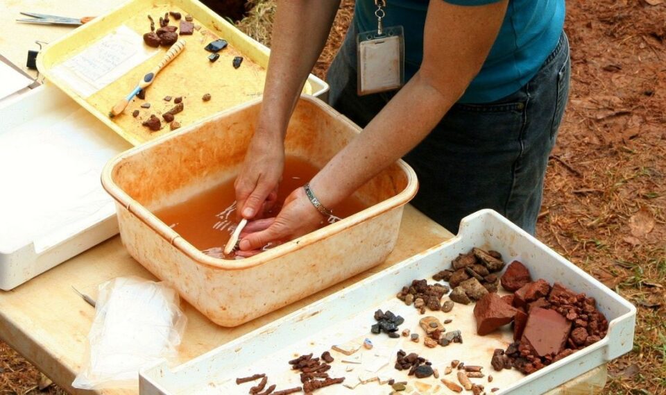
...case study of hidden depths On the global stage, a challenging scenario has been played out with the episodic implementation of Rome’s Metro line C project. Initiated using contemporary planning...

Read more of Spatial data infrastructure: critical for planning and delivering the bottom line

New approach to new business: how will your infrastructure start-up work with big data?

Posted by: Anton Hunt, Account Manager, HM Land Registry, Posted on: 2 February 2017 - Categories: Data
Entrepreneur sitting on a sofa and working on a laptop.

...now be wondering how to keep opportunities fluid while trying to swat up on what seem to be endless techniques to apply data for 3D modelling. What’s even more daunting...

Read more of New approach to new business: how will your infrastructure start-up work with big data?

How geospatial data works with GIS to map the big picture for big data

Posted by: Anton Hunt, Account Manager, HM Land Registry, Posted on: 26 January 2017 - Categories: Data
A man works a laptop while another uses a tool to fine tune an electronic circuit.

...location using the appropriate materials is both a time saver and, further down the line contributes to revenue generation and sustainable communities. Layers have meaning: standard toolkit for infrastructure professionals...

Read more of How geospatial data works with GIS to map the big picture for big data

Electronic extent data: five essentials to drive your infrastructure project

Posted by: Anton Hunt, Account Manager, HM Land Registry, Posted on: 12 January 2017 - Categories: Data
Future city design with elaborate networks of connecting structures.

...type of data for you to use for your specific project. Flexible use of data keeps your project moving and prevents bumps in the road Good business is all about...

Read more of Electronic extent data: five essentials to drive your infrastructure project

Related content and links

HM Land Registry

We register the ownership of land and property in England and Wales.

On this blog, we talk about land and property, our work and the people that do it.

Sign up and manage updates

  • Email
  • Atom

Follow us

  • Twitter
  • LinkedIn
  • Facebook
  • YouTube

Useful links

  • All GOV.UK blogs
  • All GOV.UK blog posts
  • GOV.UK
  • All departments
  • Accessibility statement
  • Cookies
All content is available under the Open Government Licence v3.0, except where otherwise stated
© Crown copyright